Nieuwe pagina aangemaakt met '===Areas=== * 300px|left City polygons derived from the place names of the roads present in these areas. For this image, enable the map layer <i>City polygons</i>. {{Clear}} * 300px|left The yellow-tinted area is an area with restriction. For this image, enable the map layer <i>Areas with restrictions</i>. {{Clear}} * 300px|left...'
(geen verschil)
Huidige versie van 16 apr 2025 om 15:18
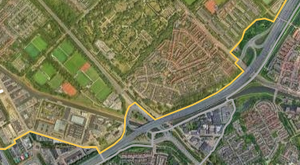
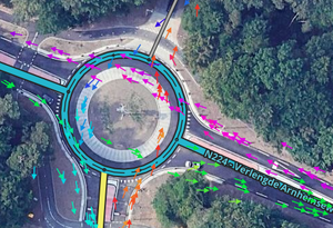
Areas
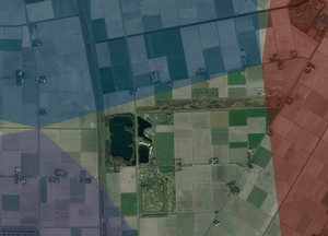
City polygons derived from the place names of the roads present in these areas. For this image, enable the map layerCity polygons.